Andrea Ainjärv
- Faculty of Architecture
- Architecture and Urban Design
- ma
- CREATING A SELF-SUFFICIENT AND ENERGY EFFICIENT SMALL SCALE URBAN COMPLEX considering the global climate change
- Tutor(s): Andres Alver, Douglas Gordon
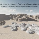
- My master thesis focuses on finding a solution to accomodation problem in the extreme desert areas as the global climate changes.
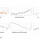
- The affects of the climate change are visible worldwide. Ice sheets are melting and the water level rises. In some areas, extreme weather conditions and rain are becoming more common, while elsewhere there are major heat waves and droughts. The planet’s average surface temperature has risen by 0.98 degrees Celsius since the 19th century, a change caused by increased concentrations of carbon dioxide and other anthropogenic greenhouse gases in the atmosphere. About 40% of greenhouse gas emissions are due to the built environment. This suggests that architectural design and urban planning can do much to combat the climate crisis.
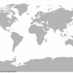
- The various effects that scientists previously predicted as a result of global climate change are now being felt on every continent. At the moment, the situation is still quite stable. Some areas are already showing catastrophic signs, but the situation is not as bad as it will be in the future.
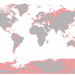
- The hypothetical situation of global warming, in which all the ice in the glaciers is melting, creates a catastrophic picture in which many cities and even countries close to the coast are buried under the flood.
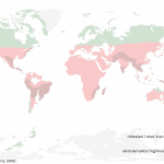
- Global temperatures will rise by an estimated 4.8 degrees by 2100. If, geographically, in addition to the melting of glacier ice, temperature warming is taken into account, the central part of the map becomes a desert or an uninhabitable area with particularly extreme conditions.
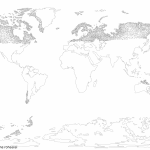
- If we take into account the migration of peoples or a large mass of people who, as a result, immigrate from hot areas to the remaining green, the remaining green area would have about 10,000 or even more million cities.
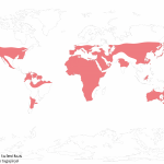
- This means that the surface of the remaining green area is mostly filled with giant cities. To avoid this, the colonization of desert areas could also be considered. This is where the most extreme conditions occur now and in the future.
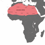
- Africa is the continent most vulnerable to climate change. In the Sahara, the world’s largest hot desert, temperatures reach 50 degrees Celsius during the day. There is minimal and non-regular rainfall. Vegetation is therefore rare.
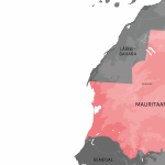
- I therefore chose the area with extreme conditions in the Sahara desert as the location for my project. Due to the very large nature of the area, I decided to choose the Mauritanian region as a more precise location.
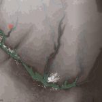
- The location is close to the existing settlement of Ouadane. In the location plan, I have highlighted the height differences of the location, the existing habitats with a white outline, the current green areas with green, the groundwater veins with blue, and the location of the existing water pump. The location of the new underground city to be created within the project is marked in red. In addition, I have added pictures describing the existing life, where the upper one is from the older city (which is mostly abandoned due to desert sand), the second from the newer temporary settlements in a dried-up riverbed and the third from the current plant and animal situation.
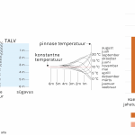
- Due to the extreme weather conditions, I decided to create the small-scale city partially underground. The temperature of the underground surface is lower than the outdoor temperature in summer and higher in winter. This is due to the thermal properties of the soil, which can be used as a heat condenser to moderate the internal temperature. Depth 0-10 meters characterizes the insulation of the outside temperature. At this depth, seasonal temperature fluctuations also decrease. As the depth increases, the temperature stability also increases. The main disadvantages of underground construction are the initial construction costs, which can be up to 20% higher than conventional construction. However, this is later compensated by lower heating and cooling costs.
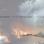
- My idea would be to create a new, functioning urban complex near the village of Ouadane to accommodate the locals so that they do not have to emigrate due to the climate. This is already a problematic area where the underground city complex could be developed, which would work even in the event of a growing crisis.
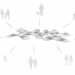
- Today’s society is not used to underground life, so there is a need to adapt to a different way of life. The residents must learn to cooperate with each other and become one big family, helping each other and working together. It is a community-based way of living – it means working together and enjoying the benefits together, and even the most important decisions are made by voting together. Thus, within the city, these different groups form a community.
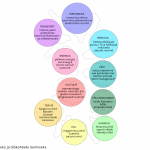
- For the functioning of the city, I have created ten larger program groups, which are divided into specific sub-functions. These sub-functions take care of all the day-to-day problems of the city and create jobs for the residents.
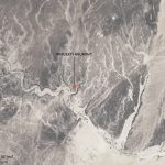
- The idea is to create an underground city that blends in to some extent with the surrounding landscape. The inspiration for the shape of the created project comes from the local topology and the imitation of the existing erosion traces.
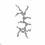
- It is also easier to excavate soil from existing sand-filled furrows. In addition, it resembles the natural cracking of the earth, creating a canyon-like structure at the cracking sites, which creates strange games of light on the canyon walls at different times of the day. Thus, an organic form is created.
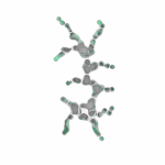
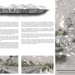
- It is very important to create greenery in the underground city. Plants need light, so they are placed in areas that receive more sunlight.
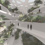
- In addition, there are green pools with landscaping or flower beds in quieter corners on different levels. This arrangement of greenery creates a bit of a hanging garden feeling, and the quieter green pools add value by muffling noise from more active areas.
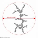
- In the underground city, all movement takes place on foot. This means that the distances must be shorter and a comfortable walking distance. People’s preferences for a comfortable walking distance vary. Therefore, when creating the city, I took into account the logic of the distance of one standard transport connection. The city is designed for 5,000 inhabitants, so the density of the city is about 12 m2 per person.
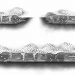
- As a minimum, it would be necessary to go 6-10 meters underground, because at this depth the ground will protect the underground city and ensure more energy-efficient temperature stability. The depth of the whole city is 24 meters and 8 floors are planned, so the height of one floor will be 3 meters, which is lower than usual, but in this environment there is no need for a higher one.
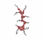
- The created main street passing through the city is the focus of all street life. It is a place where city dwellers socialize and spend their free time. The width of the main street is similar to car-free pedestrian boulevards. It is surrounded by basic and more commonly used functions.
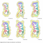
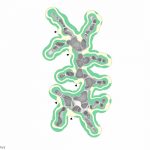
- In addition to the main street and the balconies on the sides of the atrium, there is another layer of streets in the ground, which can be seen in the floor plans. They act as shortcuts from one function to another and provide access to rooms deeper in the ground.
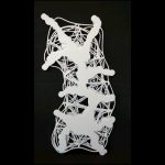
- You can also see the second layer of streets on the negative model of the city.
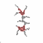
- There are larger public multi-level squares at both ends of the main street.
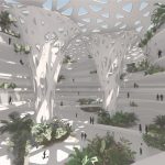
- This means that the squares also extend to the upper floors and the terraces and balconies on them.
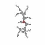
- It is also important to create a third square in the middle of them, which would become a central square and a new focus point as the city expands.
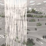
- The central square would also differ from the others in terms of its roof design, because rainwater is collected from there (if there is a rainy season). For this purpose, the roof has a corresponding opening, in which, like Singapore Airport, water falls down from roof to lower levels. Below is a pool for collection, from where water is directed to storage.
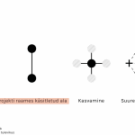
- When creating a new city, I also took into account the possible growth and decline in the future:
- – The project will create a small-scale city with a main street to connect the two main squares. Different functions gather around these squares, giving both squares their own characteristics.
- – As the city grows, another larger street is created, perpendicular to the previous one. Like the first, squares will appear at the ends of the new street, the nature of which depends on the surrounding functions, adding a variety of city squares. Thanks to the two larger streets perpendicular, the central square (previously the third square) got a new meaning. It will become the city’s new most active focal point.
- – The city covered by the project is part of a larger urban system where, thanks to the underground transport connection, it is possible to easily navigate to other similar underground cities. Thus, in case of large population growth, it is possible to create similar new cities near the city covered by the project. However the emergence of surrounding underground structures will require further research and analysis to establish connections.
- – In the future, new technologies or other developments in the world may make it unnecessary to live in an underground city, and therefore possible scenarios for urban decline must be considered. In this case, it is possible to reduce the use of the city mentally to half of the city and leave the existing space unused as a city park or, if necessary, grow full-scale food plants or keep livestock.
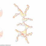
- When creating the project, I have also taken into account factors caused by the sun:
- – On the left, I have highlighted the location of the sun during the summer and winter solstice, which shows how the extent of the shadows remains very small in both cases.
- – I also did a solar radiation analysis without the roof of the building, according to the shape of the city, to determine which areas needed more shading and also where more light would be needed. The diagram shows red areas that receive more radiation and blue areas that receive less. It also shows which places the light reaches better and which less.

- The construction of the roof has several functions in the project to be created. The first is shading based on the sun analysis data. This creates larger openings on the roof where more light is needed and smaller openings where the analysis shows that the sun’s radiation was too high.
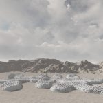
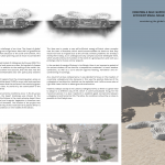
- In terms of the shape of the roof, the peculiarities of the surrounding landscape were taken into account and the shape was created similarly to sand dunes. In this way, the building blends better into the surrounding environment.
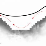
- The shape of the roof also ensures natural ventilation. To this end, I have raised the edge of the roof to the east, in order to draw fresh air into the underground city from time to time by means of strong winds from the northeast, which are more frequent at the site. Excess and used air moves out on the other side of the city structure.
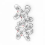
- The entrances are located on the west side of the city, where the wind is quieter.
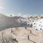
- They are located near the central main street, where the unique shape of the building creates windless courtyards for safe entry. It also leaves open the possibility of using the outdoor area near the entrances in case of milder weather conditions.
- The above-ground part under the roof is mainly a function of the entrance for both ventilation and people.
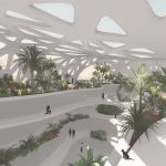
- There is also a walking area under the roof, which offers views of the spacious interior as well as the surrounding desert landscape. It is necessary as a place of leisure, reminiscent of a natural forest trail.
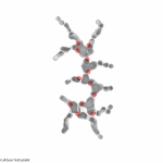
- Vertical connections are multifunctional, acting both as a connections between the floors and as support posts for the roof structure. They remain at the edges of the atrium, where they are conveniently used by those walking on the main street.
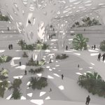
- Vertical connections are located in the immediate vicinity of the entrances to make entering the city easy and logical. It is important to note that the nodes of the vertical movement remain in a more public area and are not placed in quieter side streets.
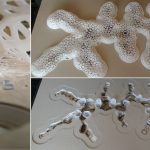
- I have also made a model for a better spatial understanding of the whole city.
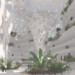
- Throughout history, people and societies have adapted to different climate changes and extremes. However, our modern lives are adapted to a stable climate. As climate conditions change, we must learn to adapt. With my master’s thesis, I propose one possible solution to this.
Printout posters as follows :
